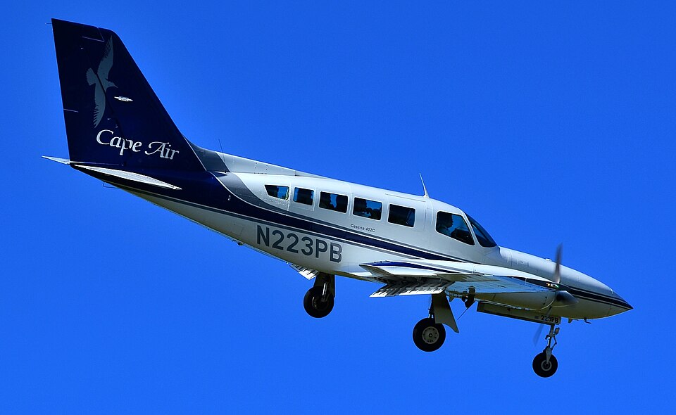
10 Feb 2015: CESSNA 402C — Cape Air

10 Feb 2015: CESSNA 402C (N223PB) — Cape Air

No fatalities • Isla de Vieques, PR, United States

Probable cause

The pilot's failure to maintain directional control during the landing roll with a strong crosswind, which resulted in a runway excursion.

— NTSB Determination

Accident narrative

On February 10, 2015, about 1139 Atlantic standard time, a Cessna 402C, N223PB, was substantially damaged when it veered off the runway while landing at Antonio Rivera Rodriguez Airport (TJVQ), Isla de Vieques, Puerto Rico. The airline transport pilot and six passengers were not injured. The airplane was registered to Hyannis Air Service Incorporated and operated by Cape Air as flight number 2811, under the provisions of Title 14 Code of Federal Regulations Part 135. Visual meteorological conditions prevailed, and a company visual flight rules flight plan had been filed for the scheduled commuter flight. The flight originated from Luis Munoz Marin International Airport (TJSJ), San Juan, Puerto Rico at 1115.The pilot reported that he made a normal landing approach to runway 9; however, shortly after touchdown the airplane encountered a gust of wind and the nose of the airplane veered to the right. The pilot attempted to regain directional control, but the airplane skidded off of the left side of the runway into the grass.

A post-accident examination by a Federal Aviation Administration (FAA) inspector revealed damage to the left wing spar and a collapsed left main landing gear. Further examination revealed that the left main landing gear was broken away from the trunnion mounts along with the brake lines. The inspector noted the presence of fresh tire skid marks on the runway and in the grass the progressed to the point where the airplane came to rest. The FAA inspector did not note any anomalies with the brake or landing gear systems.

The nearest weather reporting station was Jose Aponte de la Torre Airport (TJRV/TJNR), Ceiba, Puerto Rico, located 11 miles northwest of the accident site, at an elevation of 38 feet. At 1153, the reported weather conditions included winds from 180 magnetic at 20 knots, 10 statute miles visibility, few clouds at 2,600 feet, temperature of 29 degrees Celsius (C), dew point temperature of 22 degrees C, and an altimeter setting of 29.91 inches of mercury.

A review of the Cessna 402C pilot's operating handbook revealed that the maximum demonstrated crosswind velocity was 15 knots.

Contributing factors

  • cause Directional control — Not attained/maintained
  • cause Pilot
  • cause Effect on operation

Conditions

Weather
VMC, wind 170/20kt, vis 10sm

Loading the flight search…

What you can do on Flight Finder

  • Search flights between any two airports with live fares.
  • By aircraft — pick a plane model (e.g. Boeing 787, Airbus A350) and see every route it flies from your origin.
  • Route map — click any airport worldwide to explore its destinations, or draw a radius to find nearby airports.
  • Global aviation safety — aviation accident database, 5,200+ records since 1980, with map and rankings by aircraft and operator.
  • NTSB safety feed — recent U.S. aviation accidents and incidents from the official NTSB CAROL database, updated daily.

Frequently asked questions

How do I search flights by aircraft type on FlightFinder?

Pick an aircraft model — Boeing 737, Airbus A320, A380, Boeing 787 Dreamliner and more — enter your origin airport, and FlightFinder shows every route that plane flies from there with live fares.

Which aircraft types can I filter by?

We support Boeing 737/747/757/767/777/787, the full Airbus A220/A319/A320/A321/A330/A340/A350/A380 family, Embraer E170/E175/E190/E195, Bombardier CRJ and Dash 8, and the ATR 42/72 turboprops.

Is FlightFinder free to use?

Search and schedules are free. Pro ($4.99/month, $39/year, or $99 one-time lifetime) unlocks the enriched flight card — on-time stats, CO₂ per passenger, amenities, live gate & weather — plus My Trips with push alerts.

Where does the route data come from?

Live schedules come from Amadeus, AeroDataBox and Travelpayouts. Observed routes (which aircraft actually flew a given city pair) are crowdsourced from adsb.lol ADS-B data under the Open Database License.