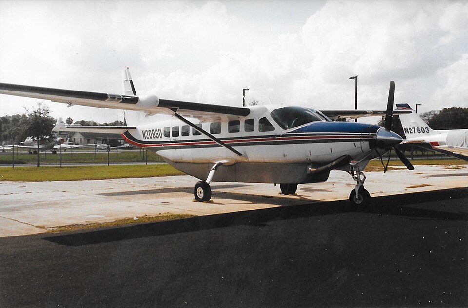
2 Oct 2016: CESSNA 208B — RAVN CONNECT

2 Oct 2016: CESSNA 208B (N208SD) — RAVN CONNECT

3 fatalities • Togiak, AK, United States

Probable cause

The flight crew's decision to continue the visual flight rules flight into deteriorating visibility and their failure to perform an immediate escape maneuver after entry into instrument meteorological conditions, which resulted in controlled flight into terrain (CFIT). Contributing to the accident were (1) Hageland's allowance of routine use of the terrain inhibit switch for inhibiting the terrain awareness and warning system alerts and inadequate guidance for uninhibiting the alerts, which reduced the margin of safety, particularly in deteriorating visibility; (2) Hageland's inadequate crew resource management (CRM) training; (3) the Federal Aviation Administration's failure to ensure that Hageland's approved CRM training contained all the required elements of Title 14 Code of Federal Regulations 135.330; and (4) Hageland's CFIT avoidance ground training, which was not tailored to the company's operations and did not address current CFIT-avoidance technologies.

— NTSB Determination

Accident narrative

The NTSB's full report is available at http://www.ntsb.gov/investigations/AccidentReports/Pages/AccidentReports.aspx. The Aircraft Accident Report number is NTSB/AAR-18/02.

On October 2, 2016, about 1157 Alaska daylight time, Ravn Connect flight 3153, a turbine-powered Cessna 208B Grand Caravan airplane, N208SD, collided with steep, mountainous terrain about 10 nautical miles northwest of Togiak Airport (PATG), Togiak, Alaska. The two commercial pilots and the passenger were killed, and the airplane was destroyed. The scheduled commuter flight was operated under visual flight rules by Hageland Aviation Services, Inc., Anchorage, Alaska, under the provisions of Title 14 Code of Federal Regulations Part 135. Visual meteorological conditions prevailed at PATG (which had the closest weather observing station to the accident site), but a second company flight crew (whose flight departed about 2 minutes after the accident airplane and initially followed a similar route) reported that they observed unexpected fog, changing clouds, and the potential for rain along the accident route. Company flight-following procedures were in effect. The flight departed Quinhagak Airport, Quinhagak, Alaska, about 1133 and was en route to PATG.

Contributing factors

  • Flight crew
  • Flight crew
  • Altitude — Not attained/maintained
  • Decision related to condition
  • Response/compensation
  • Response/compensation
  • Contributed to outcome
  • Operator
  • Operator
  • FAA/Regulator
  • Operator
  • Not used/operated
  • Related operating info
  • Capability exceeded
  • Design
  • VHF/HF radio
  • Meteo equip coverage/avail
  • FAA/Regulator
  • Other institution/organization
  • Not installed/available

Conditions

Weather
VMC, vis 7sm

Loading the flight search…

What you can do on Flight Finder

  • Search flights between any two airports with live fares.
  • By aircraft — pick a plane model (e.g. Boeing 787, Airbus A350) and see every route it flies from your origin.
  • Route map — click any airport worldwide to explore its destinations, or draw a radius to find nearby airports.
  • Global aviation safety — aviation accident database, 5,200+ records since 1980, with map and rankings by aircraft and operator.
  • NTSB safety feed — recent U.S. aviation accidents and incidents from the official NTSB CAROL database, updated daily.

Frequently asked questions

How do I search flights by aircraft type on FlightFinder?

Pick an aircraft model — Boeing 737, Airbus A320, A380, Boeing 787 Dreamliner and more — enter your origin airport, and FlightFinder shows every route that plane flies from there with live fares.

Which aircraft types can I filter by?

We support Boeing 737/747/757/767/777/787, the full Airbus A220/A319/A320/A321/A330/A340/A350/A380 family, Embraer E170/E175/E190/E195, Bombardier CRJ and Dash 8, and the ATR 42/72 turboprops.

Is FlightFinder free to use?

Search and schedules are free. Pro ($4.99/month, $39/year, or $99 one-time lifetime) unlocks the enriched flight card — on-time stats, CO₂ per passenger, amenities, live gate & weather — plus My Trips with push alerts.

Where does the route data come from?

Live schedules come from Amadeus, AeroDataBox and Travelpayouts. Observed routes (which aircraft actually flew a given city pair) are crowdsourced from adsb.lol ADS-B data under the Open Database License.