History of Flight
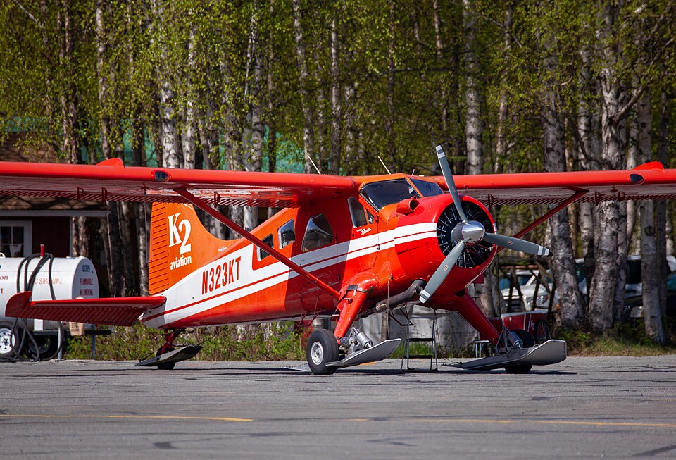
On August 4, 2018, about 1753 Alaska daylight time, a de Havilland DHC-2 airplane, registration N323KT, struck steep, snow-covered terrain approximately 50 miles northwest of Talkeetna, Alaska, within Denali National Park and Preserve. The commercial pilot and four passengers sustained fatal injuries. The aircraft, owned by Rust Properties, LLC and operated by Rust's Flying Service, Inc. (doing business as K2 Aviation), was conducting a Title 14 CFR Part 135 visual flight rules on-demand commercial air tour. Visual meteorological conditions prevailed, and company flight following procedures were active. The flight departed Talkeetna Airport at 1705 and was scheduled to return about one hour later.
The glacier tour included aerial views of multiple glaciers and the base camp area for Denali climbers. GPS track data from the company's satellite tracking program showed that at 1746, the aircraft altered course near the Denali summit and proceeded southeast down the Kahiltna glacier valley, passing abeam the Kahiltna Climber Base Camp.
At 1753, the Alaska Rescue Coordination Center received an alert from the airplane's emergency locator transmitter (ELT). At 1756, K2 Aviation's satellite tracking program notified the flight follower that tracking had ceased, and the company initiated lost aircraft procedures. Around 1800, the accident pilot placed a satellite phone call to K2 Aviation personnel. According to a company pilot in the operations area, the accident pilot stated, "[w]e've run into the side of a mountain" and requested rescue; the connection was lost. After multiple attempts, contact was reestablished, and the pilot reported being trapped in the wreckage and that there were possibly two fatalities. No further communication was received. At 2008, a National Park Service (NPS) rescue helicopter departed Talkeetna Airport en route to the ELT coordinates, but poor weather prevented locating the wreckage. On August 6, an NPS helicopter crew discovered the airplane in a crevasse on a hanging glacier on Thunder Mountain, about 14 miles southwest of the Denali summit, at an elevation of approximately 10,920 feet mean sea level.
Personnel Information
The pilot, aged 58, held a commercial pilot certificate with ratings for airplane single-engine land and sea and instrument airplane. His most recent second-class FAA medical certificate was issued on March 13, 2018, with a limitation for corrective lenses. The pilot's personal logbooks showed the last entry on April 27, 2018. Company records indicated the pilot had accumulated about 2,550 total flight hours, including 216 hours in the previous 90 days and 78.8 hours in the previous 30 days. His most recent pilot competency check under 14 CFR 135.293 was completed on May 18, 2018.
Aircraft Information
The accident airplane, manufactured in 1957, had a total time in service of 15,495.6 flight hours at its most recent 100-hour inspection on July 22, 2018. By the accident, it had accrued 48.6 flight hours since that inspection. The aircraft was equipped with a Pratt & Whitney R-985 radial engine rated at 450 horsepower. The engine had been overhauled 1,113.4 hours before the accident and had a total time in service of 2,471.6 hours.
Meteorological Information
Station models near the accident site around the time of the accident indicated light winds, broken to overcast clouds, and temperatures between 58°F and 64°F. Stations at McKinley Park Airport (PAIN) and Ft. Greely (PABI) reported moderate rain. The Alaskan Surface Analysis chart for 1900 depicted a developing stationary front north of the accident site and a high-pressure system at 1018 hPa to the south. A Global Data Assimilation System (GDAS) model sounding at 1900 estimated conditions at 11,000 feet msl: temperature -1.9°C, dew point -2.4°C, relative humidity 96%, and wind from 230° at 6 knots. The sounding estimated broken cloud bases at 700 feet agl, overcast clouds at 1,000 feet agl with tops to 21,000 feet, and higher clouds above. The freezing level was 9,866 feet msl, supporting light-to-moderate rime icing in clouds and precipitation. The wind profile showed light southwest surface winds veering to the west with height.
Wreckage and Impact Information
On August 6, an NPS helicopter crew located the airplane in a crevasse on a hanging glacier on Thunder Mountain at about 10,920 feet msl. Due to the site's inaccessibility, NTSB personnel could not reach the wreckage. The airplane was highly fragmented; the right wing had separated and fallen several hundred feet below the main wreckage. The fuselage was fractured aft of the wing's trailing edge and splayed open, with blown snow inside. An impact mark consistent with the right wing was visible in the snow, and the airplane appeared to have struck in a near wings-level attitude.
Additional Information
Due to treacherous terrain, an NPS ranger was suspended by a long line from a helicopter and positioned near the airplane. The ranger located the pilot and three passengers in the forward fuselage. Rapidly deteriorating weather limited the initial on-scene time to about five minutes. On August 10, during a second site assessment, the final passenger was located in the aft fuselage and was confirmed deceased. In a public statement, NPS stated that due to steep terrain, the crevasse, avalanche hazard, and the condition of the airplane, recovery of the deceased or removal of the aircraft exceeded an acceptable level of risk, and no recovery would be attempted. During an April 5, 2019 assessment flight, NPS rangers reported that the hazardous hanging glacier had calved over the winter, releasing an estimated 4,000 to 6,000 tons of ice and debris. No evidence of the wreckage was observed near the crash site, in the steep fall line, or on the glacier surface over 3,600 feet below. High-definition digital imagery confirmed that the wreckage was not visible on the mountain face or in the surface debris at the base of Thunder Mountain.
Organizational and Management Information
Rust's Flying Service operated 23 airplanes and employed about 30 pilots. Operations from Anchorage were under the Rust's Flying Service name, while Talkeetna-based operations were conducted as K2 Aviation, with management overseeing both. The director of operations and chief pilot were based in Anchorage, with a base chief pilot in Talkeetna. Each operation had separate flight followers. The K2 Aviation base chief pilot reported that glacier tour flights were not conducted on fixed routes; routes could change at the pilot's discretion based on weather. Pilots were expected to report route changes to base operations, but this was not required in the company's general operations manual. The director of operations stated that morning safety meetings were routine, but it was unknown if one occurred on the accident day. Formal, written preflight risk assessments were not completed; instead, they were described as a "conversation" among involved personnel. No checklist existed for flight followers to discuss with pilots before flights. CFIT training varied depending on the trainer and check airman, with no standard escape maneuver taught; a 180-degree turn was considered basic but not always optimal.