Introduction
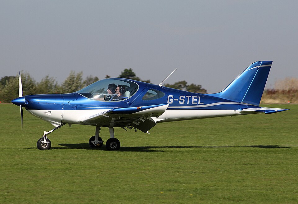
On 20 May 2025, a Bristell NG5 Speed Wing, registration G-STEL, was involved in an accident near Gordon, Berwickshire. The aircraft was destroyed and the pilot sustained fatal injuries.
History of the Flight
The pilot arrived at Nether Huntlywood Airfield to prepare for a flight to Kingsmuir Airfield. After preparing the aircraft, the pilot started the engine and taxied for departure from grass Runway 10. The aircraft took off at 0840 hrs and climbed to 610 ft aal. The pilot then turned right and reduced power, appearing to fly a pattern to land back on reciprocal Runway 28. CCTV footage showed the aircraft entering cloud as it began a left turn to align with the runway. It re-emerged with a steep left bank and nose-down attitude. The bank angle increased, and the aircraft struck the ground in a steep nose-down descent. The missing aircraft was reported to emergency services at 2011 hrs and located at 2111 hrs.
Aircraft Information
G-STEL was a Bristell NG5 Speed Wing, a single-engine, all-metal, low-wing aircraft with two side-by-side seats and a fixed tricycle undercarriage. It was powered by a Jabiru 3300A six-cylinder engine driving a two-bladed composite propeller. The aircraft was built in 2013 and had accumulated about 630 flying hours. Its last annual inspection was completed on 9 May 2025, and the Permit to Fly was renewed until 11 May 2026. The previous inspection revealed a low compression reading on cylinder five, but the aircraft was scheduled for routine engine maintenance and flew three times after the inspection.
Recorded Data
The aircraft was equipped with a Primary Flight Display (PFD), Engine Monitoring System (EMS), and a tablet with a flight planning app. These devices recorded data during the flight. Additionally, CCTV recordings from the airfield captured the aircraft before the accident. The recorded data showed that the aircraft took off at 0840:10 hrs, climbed to a maximum GNSS altitude of 1,177 ft amsl (627 ft aal), and then began a descending right turn. The descent rate reached up to 1,377 ft/min, and the bank angle increased to approximately 30° to the right. After turning 180°, the aircraft briefly levelled at 980 ft amsl before continuing its descent. At 0841:49 hrs, the right turn was reversed into a left turn when the aircraft was 0.6 nm from the Runway 28 threshold at 753 ft amsl (203 ft aal). CCTV showed the aircraft disappearing from view for several seconds, indicating possible cloud or poor visibility. The left turn steepened and continued until the end of the recording. The final recorded GNSS position was at 0842:01 hrs at 639 ft amsl (89 ft aal), descending at approximately 1,400 ft/min.
Accident Site
The impact site was confined to the area of the aircraft. Ground indentations and damage to the left wing and fuselage indicated the aircraft struck the ground in a nose-down attitude while rolling to the left. The aircraft bounced and turned approximately 90° before coming to rest upright. The canopy broke and detached. Both fuel tanks were disrupted, and fuel leaked into the ground. One propeller blade remained attached, while the other was embedded in the ground. The ignition key was found bent and selected to the left ignition position.
Aircraft Examination
Examination of the flying controls found the aileron and rudder control runs intact; the elevator control rod was broken due to fuselage buckling. The flaps were retracted. The fuel selector valve was selected to the left wing, which the pilot had refuelled before the flight. A fuel sample from the hangar supply complied with E5 mogas specifications. The engine could be rotated by hand and showed no pre-impact anomalies. Disassembly of the engine and carburettor revealed nothing that would have prevented operation. Engine data from the EMS showed parameters within expected ranges, and the engine operated until impact.
Meteorological Information
The Met Office produced an aftercast of the weather in the area at the time of the accident.