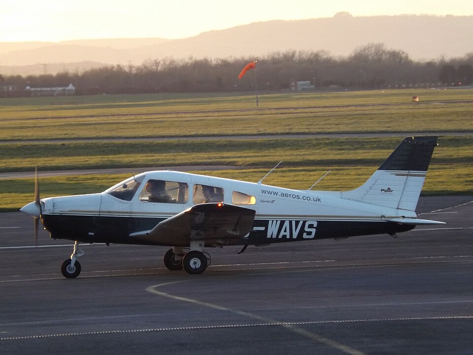
History of the Flight
The aircraft was operated by a flying school at Coventry Airport. Earlier that day, the instructor had conducted local instructional flying before being asked by operations staff to deliver the aircraft to its maintenance base at Gloucester Airport, a routine movement for the school. The pilot expressed concerns about the weather and appeared anxious to start the trip as soon as possible.
The plan involved two Coventry-based aircraft, G-WAVS and G-USAA, both requiring engineering input, to fly to Gloucester around the same time, each with two pilots. All four pilots would then return to Coventry in another aircraft whose maintenance was completed. The accident aircraft's instructor was accompanied by a student nearing the navigation phase of his training; the flight would provide additional exposure. The student prepared a route on a 1:500,000 scale aeronautical chart following a standard route used by the school for such ferry flights. The highest terrain along or adjacent to the route was shown as 1,048 ft amsl, with a maximum elevation figure of 1,400 ft amsl. Both crews conducted their own briefs and weather consultations; there was no combined brief or supervision by flying school management (none was required). The crew of G-WAVS did not use GPS navigation or flight planning software.
Prior to departure, a pilot (believed to be the instructor) contacted Wellesbourne Airfield to check conditions and was informed that an aircraft airborne in the vicinity reported cloud overcast at 800 ft agl. G-USAA departed Coventry at 1206 hrs, and G-WAVS departed at 1208 hrs. Both turned south-west towards Stratford-upon-Avon and passed near Wellesbourne Airfield, contacting it by radio. They were aware of each other's proximity and transmitted air-to-air position checks to maintain separation.
Southwest of Stratford, both aircraft followed similar tracks at approximately 1,000 ft. The cloudbase in the area was about 1,000 ft amsl with freezing conditions forecast in cloud. The crew of G-USAA later stated that visibility reduced as they flew further south and west, and they frequently used carburettor heating. Near Evesham the tracks diverged, with G-WAVS flying further north. At around 1230 hrs, an aircraft believed to be G-WAVS was seen manoeuvring very low in the Evesham area; radar data indicated altitudes between 700 and 1,000 ft amsl.
Witnesses in the Elmley Castle area described the weather as "quite foggy". They heard an aircraft flying low before it appeared out of the cloud; one witness remarked it seemed to be "pulling up". The aircraft then struck trees near the summit of Bredon Hill at approximately 940 ft elevation and came to rest in a field further southwest.
Accident Site
The accident site was near the summit of Bredon Hill at an elevation of about 940 ft. There is a mast on the summit with an elevation of 1,046 ft, marked on the aeronautical chart. Inspection indicated the aircraft struck the tops of trees on a heading of approximately 230°. This initial impact detached a 1.8 m portion of the outer left wing and part of the left aileron. The aircraft then rolled left and descended to the ground about 170 m past the trees, landing on its left side in a nose-down attitude, causing further substantial damage. The aircraft contacted the surface close to a stone wall (not contacted) and came to rest. This indicated a steep final descent at slow forward speed.
Aircraft Examination
Preliminary examination of the wreckage, including propeller damage, indicated the engine was producing power at impact. Both fuel tanks were ruptured with no fuel remaining, but initial responders reported a strong smell of fuel, indicating fuel had been present. No pre-accident defects were identified. The wreckage was recovered to the AAIB facilities for further examination, which revealed no pre-existing defects or anomalies that may have contributed to the accident. The altimeter was set to 1022 hPa.
Meteorology
Forecast and actual weather for the Coventry area showed light north-easterly winds with a cloud base around 1,000 ft. Gloucester weather at the time of the accident also showed a light north-easterly wind, visibility reducing to 3,500 m in drizzle and mist, and a cloud base of approximately 600 ft. The low-level forecast chart (Figure 5 in the report) is believed to have been consulted by the crew; a copy was found on the instructor's desk at Coventry Airport.
Recorded Information
Radar tracks were obtained for both aircraft. G-WAVS flew from Coventry towards Warwick and Stratford-upon-Avon at altitudes between 800 and 900 ft amsl. G-USAA initially tracked north of G-WAVS at 1,100-1,200 ft amsl. Both aircraft descended about 300 ft south of Stratford-upon-Avon, and their tracks converged. G-WAVS then turned northwest and flew several low-level orbits near Evesham before heading toward Bredon Hill. The final radar return was 200 m from the accident site.
The aircraft was equipped with a panel-mounted GPS system that was selected on, but no data from the accident flight route was retrieved; only the last known position (the accident site) was stored. Radio contact with Gloucester ATC was recorded; both pilots' voices were audible, and the last transmission was at 1225 hrs while the aircraft was manoeuvring near Evesham.