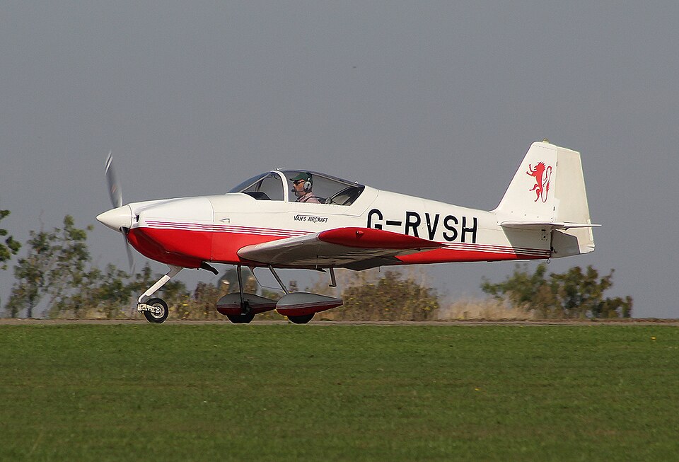
History of the Flight
The pilot of G-RVSH, a Vans RV-6A, planned a flight from White Waltham Airfield to Truro Airfield, a grass airstrip in an actively farmed field. He called the airfield owner at approximately 1145 hrs, requesting permission to land and stating the flight time would be about 1 hour 15 minutes. At about 1355 hrs, the owner heard the aircraft in the vicinity and saw it on the downwind leg for Runway 14, while noting the windsock had shifted in favour of Runway 32.
Witnesses observed the aircraft approaching to land on Runway 14. As it touched down, it appeared to bounce twice before tipping over its nose and then onto its back adjacent to a mound. The owner went to assist the pilot while another witness called emergency services.
Accident Site
The aircraft came to rest approximately 20 m to the right of Runway 14 after a ground roll of roughly 100 m. The first ground marks consisted of three tyre tracks in the grass, starting to the side of and about halfway down the runway length. The three tracks were consistent with all three wheels touching down simultaneously and ran parallel to the runway until adjacent to the north side of a mound. The right landing gear wheel track ended near the mound's periphery. About 6 m after the right track ended, partial remains of the nose wheel spat were found. A deep furrow created by the nose landing gear began before the right tyre track ended. At approximately the same position, the left wing tip contacted the grass, confirmed by light scratches on the left wingtip structure. The nose landing gear furrow extended another 10 m beyond the spat remains, with the left tyre track ending about halfway along. After a gap of about 2 m beyond the furrow, an indentation was made by the propeller spinner. The aircraft came to rest inverted just beyond this indentation.
Witness Evidence
The airfield owner told the AAIB that he confirmed to the pilot that the airfield had two runways, Runway 14 and Runway 32, and that the windsock indicated the wind was about 5 kt favouring Runway 14. However, he advised the pilot to check the windsock on arrival and, due to the downward slope on Runway 14 and light wind, recommended considering a landing on Runway 32. He also briefed that circuits were at 800 ft agl to the north with no dead side.
When the owner heard the aircraft overhead, he moved to a balcony with a view toward Runway 32. The increasing slope of the field obscured his view of the far end, including the first half of Runway 14. He noted the wind now favoured Runway 32. He reported the approach seemed normal but faster than expected for a tailwind and the aircraft landed long.
The owner and another witness stated the aircraft seemed to bounce twice and appear out of control before the right main wheel contacted the side of a mound as it bounced into the air, then landed and rolled over its nose onto its back. The other witness commented that the aircraft seemed to have landed off the runway.
A farmer clearing bales on the north-eastern side saw the approach to Runway 14. He perceived the aircraft was over the runway but faster and deeper than expected.
Recorded Information
G-RVSH was equipped with a Mode-S transponder. Radar and flight tracking data were available. The investigation found no evidence the pilot was in contact with ATC at Exeter, Culdrose, or Newquay before arriving at Truro.
Two onboard digital avionic devices, an EKP-V and an iEFIS, recorded flight parameters. The last wind data calculation, as G-RVSH crossed the threshold of Runway 14, indicated wind from 010 at 6 kt, consistent with forecast conditions. This gave a tailwind component of about 3 kt.
GPS tracks from both devices showed that G-RVSH was offset to the right of the Runway 14 edge by about 20 m, corroborating the wheel track marks.
Analysis of approach data showed the airspeed was about 90 kt at the start of the approach, reducing to about 65 kt at the flare. At the time the wheel tracks began (point B), the recorded airspeed was about 50 kt (estimated groundspeed 53 kt). At the rollover (point C), GPS calculated groundspeed was 35 kt, but PFD airspeed was 24 kt (estimated groundspeed 27 kt).
Aerodrome Information
Truro Airfield is located about 4 miles north-west of central Truro at an elevation of 400 ft amsl. It has a single grass runway, 20 m wide, oriented approximately 140°/320°. Runway 14 has a 1.8% downhill slope. It is an unlicenced airstrip with no requirement for regulatory oversight.
Safety Action
The airfield owner has taken safety action to provide more information on the Pooley’s plate. A helicopter training mound has been removed from the airfield.