History of the Flight
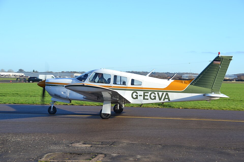
On Saturday 2 April 2022, the two occupants of G-EGVA — a Piper PA-28R-200-2 (serial no. 28R-7635229) — departed Wellesbourne Mountford Aerodrome as part of a flying club ‘fly-out’ to Le Touquet, France. The aircraft took off at approximately 0754 hrs, the second of six VFR aircraft. Another aircraft flew under IFR. Each pilot conducted their own planning and weather assessment. G-EGVA was a faster aircraft and overtook the first VFR aircraft near Basingstoke.
At 0759 hrs, the pilot contacted London Information to activate the flight plan, then transferred to Farnborough Radar before returning to London Information at 0839 hrs, reporting position 1 nm west of Littlehampton at 5,000 ft. At 0846 hrs, a video posted online by the right-seat pilot showed the instrument panel: altimeter at 5,000 ft, heading approximately 090°, airspeed about 115 kt, autopilot not engaged, and cumulus cloud visible ahead. Both occupants wore lifejackets, with shoulder harnesses worn under them.
The last radio exchange occurred at 0916:10 hrs when G-EGVA reported, “we’re currently in cloud.” London Information had attempted to confirm the aircraft’s position for handover to Lille Radar. The Flight Information Service Officer then contacted Distress and Diversion after losing contact. Radar replay showed G-EGVA last visible at 0916:31 hrs at 50°34’23.49” N 001°04’11.23” E, 20 nm west of Le Touquet, in a rapid descent. French and UK rescue coordination centres launched a search involving vessels and aircraft; nothing was found initially. Subsequently, a bag containing the left-seat pilot’s licence and logbook was found at Plage d’Equihen, a kneeboard belonging to the right-seat pilot at Plage de Wimereux, and a seat from G-EGVA at Plage de Sainte-Cécile.
Weather and Other Aircraft Reports
Forecast weather on 2 April showed a slack pressure pattern with a convergence line from the Dover Strait to Le Mans. A Met Office low-level forecast chart indicated overall good visibility but a line of highly convective cloud over the English Channel. Pilots of the other five VFR aircraft all encountered this line of cumulus cloud. Four descended to find gaps and continued to Le Touquet. The last VFR aircraft diverted to Shoreham. The IFR pilot estimated cloud tops at least 8,000 ft at 0825 hrs. Photographs taken at 0918 hrs showed waterspouts descending from the cloud base, and at 0924 hrs cloud extending to the surface.
Radar Data
Secondary surveillance radar data showed G-EGVA descending from cruise altitude of about 5,000 ft to 3,000 ft at approximately 500 fpm, then climbing to over 7,000 ft at about 1,000 fpm while maintaining an easterly track. Over 50 seconds the aircraft varied altitude and turned right, left, and right again through 50°. Then it turned right in a descent; radar contact was lost 40 seconds later as it descended through 4,600 ft with a calculated descent rate of nearly 10,000 fpm. The final radar position was at 0916:31 hrs.
Airspace
A Danger Area was active in the English Channel on the day, prohibiting flight below 1,500 ft amsl. Class A airspace existed above FL75. Thus G-EGVA was limited to flight between 1,500 ft and FL75.
Probable Cause
The available evidence suggests that control of the aircraft was lost when it entered cloud. Neither occupant was qualified to fly in cloud.