Ultralight Crash in Chonburi Kills Pilot Due to Wing Fabric Failure
An X-AIR HAWK ultralight crashed in Chonburi, Thailand, killing the pilot and injuring a passenger. The accident was caused by deteriorated wing fabric and…
On February 24, 2016, a De Havilland DHC-6 Twin Otter (registration 9N-AHH) operated by Tara Air was involved in an aviation accident near Dana, Nepal in flight. 23 people were killed. Investigators recorded the probable cause as: The crew's repeated decision to enter clouds during a VFR flight in unfavorable weather, combined with deviation from the normal track due to loss of situational awareness aggravated by spatial disorientation, led to a controlled flight into terrain (CFIT)… This summary draws on records from the Bureau of Aircraft Accidents Archives (B3A); 2 related events involving the same aircraft type or operator are linked below.
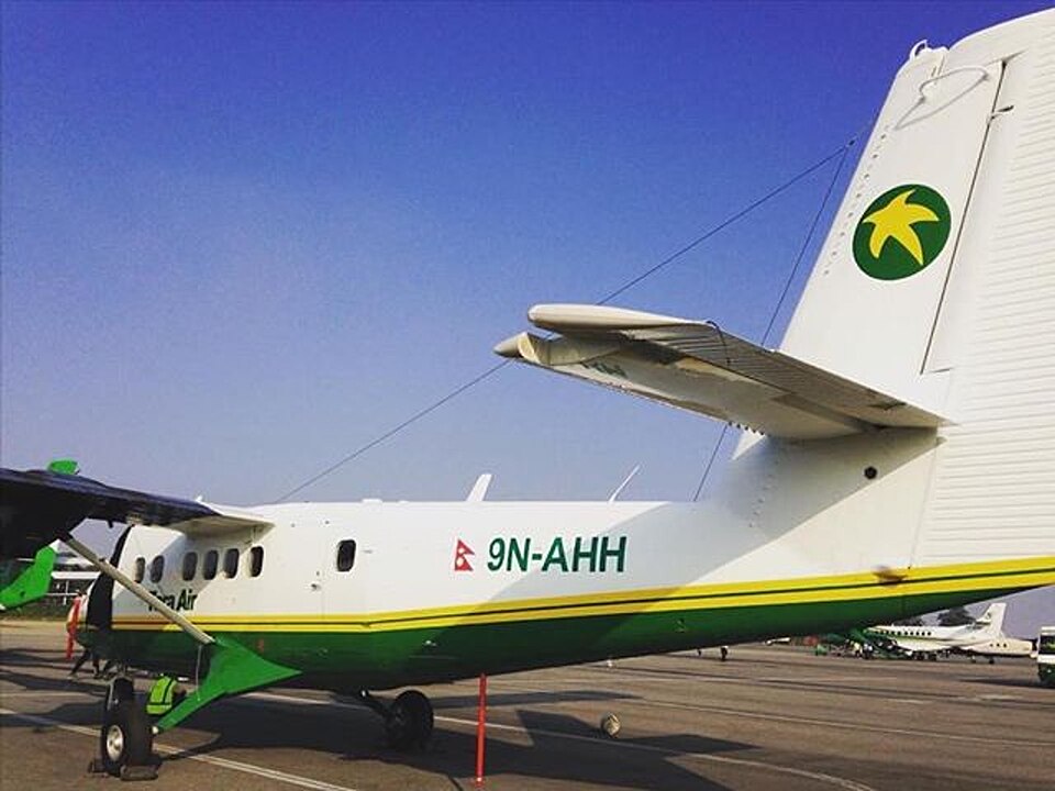
An aircraft on a VFR flight to Jomsom entered clouds in unfavorable weather. Loss of situational awareness and spatial disorientation led to a controlled flight into terrain accident.
The crew's repeated decision to enter clouds during a VFR flight in unfavorable weather, combined with deviation from the normal track due to loss of situational awareness aggravated by spatial disorientation, led to a controlled flight into terrain (CFIT) accident. Contributing factors included loss of situational awareness, deteriorating weather, skill-based errors during critical phases, and failure to utilize available resources, particularly insensitivity to EGPWS cautions and warnings.
An X-AIR HAWK ultralight crashed in Chonburi, Thailand, killing the pilot and injuring a passenger. The accident was caused by deteriorated wing fabric and…
A Challenger II Special ultralight aircraft (U-B23) landed off-runway at Pai Airport, Mae Hong Son, on September 17, 2024, due to a gust of wind. No injuries…
The Polish aviation safety authority is investigating a serious incident involving an AT-3R100 aircraft that occurred on September 2, 2024. The investigation…
A SZD-48-3 glider suffered damage when its left wing struck a ground obstacle during a low final approach at EPWK on June 20, 2025. The pilot was uninjured.
A 39-year-old skydiver died after a hard landing near Leszno on May 1, 2026. The PKBWL preliminary report indicates the fatal impact resulted from a late,…
A student pilot crashed an SZD-50-3 Puchacz glider into the airfield fence during a solo training flight on June 6, 2026. The pilot was uninjured, but the…