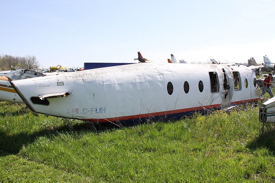
On August 12, 1999, a Beechcraft 1900D (registration C-FLIH) operated by RégionnAir was involved in an aviation accident near Seven Islands, Canada during landing or approach. One person was killed. Investigators recorded the probable cause as: The pilot flying did not establish a maximum performance climb profile when the GPWS 'Terrain, Terrain' warning sounded, did not fly a stabilized approach, and the crew did not carry out a go-around. This summary draws on records from the Bureau of Aircraft Accidents Archives (B3A); 1 related events involving the same aircraft type or operator are linked below.
A RégionnAir Beechcraft 1900 crashed after a non-stabilized approach to Runway 31 at Seven Islands. The crew flew an unpublished GPS approach in poor weather, leading to a terrain impact.
Flight Details and Approach Sequence A RégionnAir flight departed Port-Menier at 23:34 for an instrument flight rules (IFR) flight to Seven Islands. The crew elected to perform a straight-in GPS approach to Runway 31, despite the absence of a published GPS approach for that runway. The descent from cruise altitude began late, leaving the aircraft high and fast during the approach phase to the non-directional beacon (NDB). From an altitude of 10,000 feet at 9 nautical miles from the NDB, the rate of descent generally exceeded 3,000 feet per minute. The aircraft crossed the beacon at 600 feet above sea level. During the final 30 seconds of flight, beginning approximately 3 nautical miles from the threshold, the aircraft descended steadily at about 850 feet per minute at 140 to 150 knots indicated airspeed with full flaps extended. The captain coached the first officer throughout the descent, calling out altitudes and distances. ## Warning Activations and Impact The ground proximity warning system (GPWS) “Minimums” activation sounded, consistent with a 100-foot decision height selection. The captain responded by directing a continued slow descent. The final call was at 30 feet, 1.2 seconds before impact. Eight seconds before impact, the GPWS voice message “Minimums, Minimums” activated. The aircraft continued its descent and struck trees in a near-level attitude in an area of rising terrain. A post-crash fire destroyed the wings, the right engine, and the right midside of the fuselage. The cabin area remained relatively intact, while the cockpit area separated and was crushed during the impact sequence. ## Aircraft and Operational Context The Beechcraft involved was a brand-new aircraft registered just two months earlier. This accident was RégionnAir’s second Beech 1900 loss in 1999; on January 4, another accident occurred on approach to St. Augustin River, with no fatal injuries. ## Official Findings The official findings identified several causes and contributing factors. The pilot flying did not establish a maximum performance climb profile when the GPWS “Terrain, Terrain” warning sounded during the descent in cloud to the NDB, contrary to company standard operating procedures (SOPs). The pilot flying did not fly a stabilized approach, and the crew did not execute a go-around when it was clear the approach was not stabilized. The crew descended the aircraft well below safe minimum altitude in instrument meteorological conditions. Throughout the approach, even at 100 feet above ground level, the captain asked the pilot flying to continue the descent without visual contact with the runway environment. After the GPWS “Minimums, Minimums” activation at 100 feet, the rate of descent continued at 850 feet per minute until impact. The crew planned and conducted, in cloud and low visibility, a user-defined GPS approach to Runway 31, contrary to regulations and safe practices. Risk findings included that the reported ceiling and visibility were well below published minima. Because the runway lacked a reporting runway visual range system, flying the NDB approach was allowable under existing regulations. The crew did not follow company SOPs for approach and missed-approach briefings. Both crew members had exceeded maximum monthly and quarterly flight times and maximum daily flight duty times, increasing fatigue risk. The first officer likely suffered from chronic fatigue, having worked an average of 14 hours per day for the last 30 days with only one day of rest. Transport Canada was not aware that the company’s pilots were exceeding flight and duty times, and the company operations manager did not effectively supervise these times. The captain had not received mandatory training in pilot decision making or crew resource management. Other findings noted that the emergency locator transmitter activated on initial impact but ceased transmitting shortly thereafter when its antenna cable was severed.
Probable cause
The pilot flying did not establish a maximum performance climb profile when the GPWS 'Terrain, Terrain' warning sounded, did not fly a stabilized approach, and the crew did not carry out a go-around. The crew descended well below safe minimum altitude in instrument meteorological conditions, and the captain directed continued descent without visual contact. After the GPWS 'Minimums, Minimums' activation, the descent continued at 850 feet per minute until impact. The crew planned and conducted a user-defined GPS approach to Runway 31 in cloud and low visibility, contrary to regulations and safe practices.