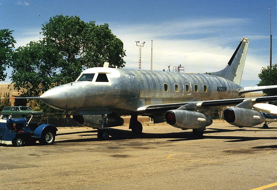
Disappearance and Search
On May 15, 2017, at 1:39 PM eastern daylight time, radar and voice communication were lost with a Mitsubishi MU2B-40 airplane, registration N220N, over international waters near Palmetto Point Eleuthera, Bahamas. The following day, debris associated with the airplane was found floating in the area alongside a fuel sheen. The United States Coast Guard conducted an air and sea search for three days, but the commercial pilot and three passengers were not located.
Flight Details
The airplane had departed Rafael Hernandez Airport (TJBQ) in Aguadilla, Puerto Rico, around 11:00 AM, destined for Space Coast Regional Airport (TIX) in Titusville, Florida. Instrument meteorological conditions prevailed, and an instrument flight rules flight plan was filed for the personal flight, conducted under 14 Code of Federal Regulations Part 91.
Aircraft and Pilot Information
According to Federal Aviation Administration (FAA) records, the airplane was a 1981 model and had been registered to its current owner on January 23, 2017. It had flown the same route several times in the four months since purchase. The pilot held a commercial pilot certificate with ratings for airplane single-engine land, multiengine land, and instrument airplane. His most recent FAA third-class medical certificate was issued December 12, 2016, and he reported 1,480 total hours of flight experience at that time. The airplane's most recent annual inspection was completed December 30, 2016, at 4,634.2 total aircraft hours; a 100-hour inspection was scheduled for May 16, 2017.
Radar and Communications
Preliminary radar and voice communication data from the FAA revealed that the airplane departed TJBQ, climbed to Flight Level 240 (24,000 feet), and maintained the same relative heading, airspeed, and altitude for about 2.5 hours. As it entered an area of overlapping radar coverage handled by Miami Air Route Traffic Control Center (ZMA), Nassau Approach Control, and Grand Turks Radar, ZMA management noted that radar targets transitioning this area at low altitude typically enter a "coast" status for about one minute before being fully reacquired. After approximately three minutes in coast status, the ZMA controller attempted to contact N220N without success. No further communications were received despite multiple attempts, and no subsequent radar targets associated with the airplane were acquired. The floating debris and fuel sheen were located in an area consistent with the airplane's final radar target.
Weather Conditions
At 2:00 PM, the weather recorded at Linden Pindling International Airport (MYNN), about 80 miles west of the airplane's track, included scattered clouds at 1,200 feet, a broken ceiling at 3,000 feet, an overcast ceiling at 10,000 feet, calm wind, visibility 10 statute miles in light rain, temperature 26°C, dew point 23°C, and an altimeter setting of 29.97 inches of mercury. Satellite imagery in the area depicted a consistent cloud layer with cloud tops around Flight Level 400 (40,000 feet), and upper air soundings confirmed icing conditions between -10°C and -20°C in clouds. At 1:40 PM, a pilot report (PIREP) was issued for light to moderate rime icing, received from a Boeing 737.
Occupants and Injuries
The airplane carried one pilot and three passengers. All four occupants are listed as fatalities in the official report.