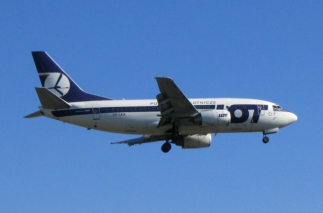
History of the Flight
On 4 June 2007, a Boeing 737-500, registration SP-LKA, operated a commercial passenger flight from Warsaw to London Heathrow (LHR). After landing at 0838 hrs, the crew performed a fast realignment procedure for the two Inertial Reference Systems (IRSs). The co-pilot entered the ground position into the Flight Management Computer (FMC) using the commercial chart position for Stand 114. Although the coordinates entered were numerically correct, the longitude was entered as East instead of West, resulting in a position approximately 33.5 nm east of the actual aircraft location.
The aircraft departed for the return flight to Warsaw at 1007 hrs. Immediately after takeoff from Runway 09R, the pilots observed that most information on both Electronic Attitude Director Indicators (EADIs) and Electronic Horizontal Situation Indicators (EHSIs) had disappeared. Approximately 40 seconds after takeoff, the aircraft entered Instrument Meteorological Conditions (IMC) at about 1,500 ft above airfield level. The co-pilot, who was handling, had to fly using the standby attitude indicator and standby magnetic compass. The autopilots were unavailable, but the autothrottle remained functional.
The commander contacted London Terminal Control North East (TCNE) Departures and reported a navigation problem. The controller assigned headings, but the aircraft responded slowly and erratically. The crew had difficulty following radar headings. After several exchanges, the commander decided to return to LHR. The controller provided radar vectors and issued 'start and stop' turn instructions. At 1032 hrs, the commander reported the runway in sight and was cleared for a visual approach to Runway 09L, landing at 1035 hrs after a flight of 27 minutes. No injuries were reported, and the aircraft sustained no damage.
Aircraft Navigational Equipment
The aircraft was equipped with an Electronic Flight Instrument System (EFIS), two independent IRSs, and one Flight Management Computer (FMC). IRSs were controlled through a Mode Select Unit (MSU) with information displayed on an IRS Display Unit (ISDU). The sole source of attitude and heading information (excluding standby instruments) came from the IRSs. The flight deck included standby attitude, altitude, airspeed instruments, and a direct-reading magnetic standby compass mounted above the glareshield.
During the fast realignment procedure, if an entered position is not within 4 nm of the airport position, an FMS alerting message 'VERIFY POSITION' appears. If the aircraft moves before alignment completes, an 'IRS MOTION' message is displayed. The incorrect longitude entry (East instead of West) caused the alignment to proceed with an erroneous position, leading to the failure of the primary navigation displays.
Investigation Findings
The investigation determined that an incorrect stand position had been entered into the Flight Management System (FMS) during the pre-flight procedure. Specifically, the longitude coordinate was entered as East instead of West, placing the initial position approximately 33.5 nm east of the actual location. This error resulted in the IRS providing incorrect attitude and heading data, causing the EADIs and EHSIs to display almost no information. The crew relied on standby instruments for the remainder of the flight.