History of the Flight
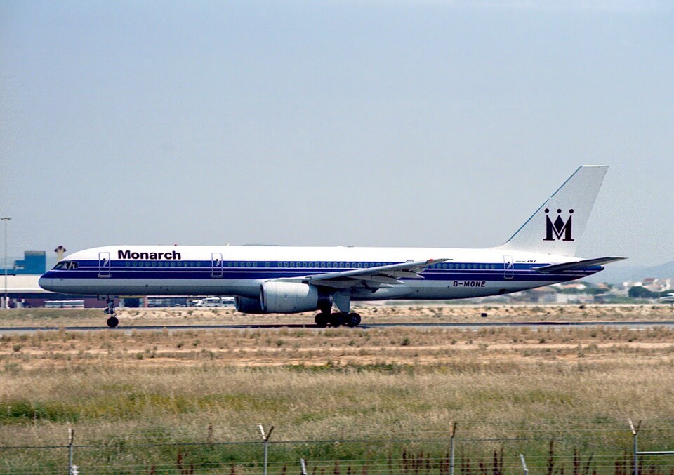
On 17 March 2006 at 1945 hrs, a Boeing 757-2T7, registration G-MONE, was conducting a public transport passenger flight from Luton Airport to Gibraltar Airport. The crew consisted of a commander (ATP licence, age 45, 11,772 hours total, 8,381 on type) and a first officer. The commander was the handling pilot per company regulations requiring nominated captains for Gibraltar landings. Prior to departure, the crew checked the destination weather, which indicated current and forecast conditions within JAR-OPS limits (1,000 ft cloud ceiling and 5,000 m visibility) but with a possibility of temporary deterioration. They carried an extra 1,000 kg of fuel.
The flight was uneventful apart from occasional moderate turbulence. Within radio range of Gibraltar, the crew received a weather update: surface wind 060° at 10 kt, visibility 5,000 m, lowest cloud scattered at 1,000 ft. The commander briefed the first officer on the surveillance radar approach (SRA) and missed approach procedure for Runway 09.
During descent, the aircraft was transferred to Gibraltar Approach and cleared to 1,500 ft with radar vectors to point 'Victor', 9 nm south of Gibraltar. The crew received further weather: visibility 5,000 m in rain, cloud few at 1,000 ft, scattered at 1,800 ft, broken at 3,000 ft. The aircraft was flown on autopilot with autothrottles engaged; each pilot had 'Map' displayed on the horizontal situation indicator (HSI). The commander checked map accuracy using Gibraltar DME. The aircraft positioned on a northerly heading past 'Victor' and was cleared to commence descent at the 5.0 nm Radar Fix. The commander selected a vertical descent speed of 700 ft/min and indicated airspeed of 135 kt. It was drizzling but the aircraft was clear of cloud; the crew could see lights of ships but no land lights.
Approaching the Visual Decision Point (VDP) at 1,000 ft, the map display accuracy was confirmed and the commander saw runway strobe lights in the expected position. Both pilots confirmed visual. The commander selected 090° on the heading selector, the aircraft started a right turn at 20–25° angle of bank. He disconnected autopilot and autothrottles, selected flight director off, and maintained bank angle and descent rate of about 700 ft/min. He continued to check the strobe lights. The first officer monitored heading, pre-selected Tower frequency, and monitored airspeed. ATC asked if they were still visual with the strobe lights. The commander lost sight of the strobe lights and asked the first officer, who also was not visual. The commander called "GO-AROUND, FLAP 20" and applied manual go-around thrust without selecting the 'Go-Around' switch. When a positive rate of climb was achieved, gear was retracted. The first officer informed ATC and noted the Attitude Director Indicator (ADI) was not annunciating 'GA'; the commander then selected the switch, and 'GA' annunciated with flight directors commanding a climb on existing track. ATC instructed a right turn onto 180°. The first officer selected heading 180° and noted high ground on the left side of his HSI. The Enhanced Ground Proximity Warning System (EGPWS) 'TERRAIN' function had been selected prior to the approach. Once level at missed approach altitude, the commander diverted to Malaga Airport, considering low cloud may have caused loss of visual contact. The diversion was uneventful and the crew reported the incident on return to Luton.
Recorded Information
The AAIB was not informed until 22 March; by then the Flight Data Recorder (FDR) and Cockpit Voice Recorder (CVR) had been overwritten. Quick Access Recorder (QAR) data was available, as was recorded radio telephony (R/T).
QAR Data
The flight path was reconstructed from QAR data. G-MONE tracked north on 001°M towards the VDP. At the VDP, altitude was approximately 1,000 ft, computed airspeed 133 kt, descending at just under 900 ft/min. The aircraft then entered a descending right turn, achieving a maximum recorded bank angle of just over 26°. Thirty seconds after the turn commenced, engine thrust increased for the go-around. At that point, G-MONE was descending through 650 ft at 134 kt, bank angle 8° right, heading 077°M. The aircraft descended a further 100 ft to 550 ft before entering a climb, achieving about 3,000 ft/min climb rate while turning onto heading 140°M. It held this heading for 12 seconds, then turned left to 134°M for 12 seconds, then right to 180°M. As it turned onto 180°M, it was overland and climbing through 2,100 ft.
R/T Information
Both Approach and Talkdown frequencies were recorded. G-MONE was transferred to Talkdown at 1940 hrs. At 1945:19 hrs, the aircraft was heading 360°M at 1,500 ft amsl, 5.5 nm from touchdown. The controller cleared descent for a 3° glidepath at 5 nm range and provided advisory altitudes. At 4 nm, G-MONE was cleared to land. At 3 nm (VDP), at 1946:30 hrs, the controller asked for confirmation of visual with the runway. After no immediate response, a further request was transmitted; the crew confirmed visual and G-MONE was cleared to continue visually. Forty-seven seconds after passing the VDP, the controller transmitted that the aircraft appeared south of track and asked for confirmation of visual contact. The crew replied they were not visual and were going around. The controller instructed to tighten the turn. Fifteen seconds later, contact was regained and the aircraft was instructed to turn right onto 180°. At 1948:15 hrs, the controller advised the aircraft was passing west of Europa Point. At 1949:28 hrs, the crew requested diversion to Malaga.
Operational Information
Operating Company Information
The company assessed Gibraltar as a Category 'B' airport. The approach was flown by a nominated captain. Following the incident, ATC and the operating company made procedural changes to reduce the chance of a similar occurrence. It was also considered that airport lighting should be improved, and a recommendation was made to that effect.
Airport Information
Gibraltar Airport Runway 09 has a sea wall indicated by omni-directional red lights and a runway threshold indicated by uni-directional green lights. Precision Approach Path Indicators (PAPIs) for Runway 09, set for a 3° descent, are positioned in accordance with regulations.