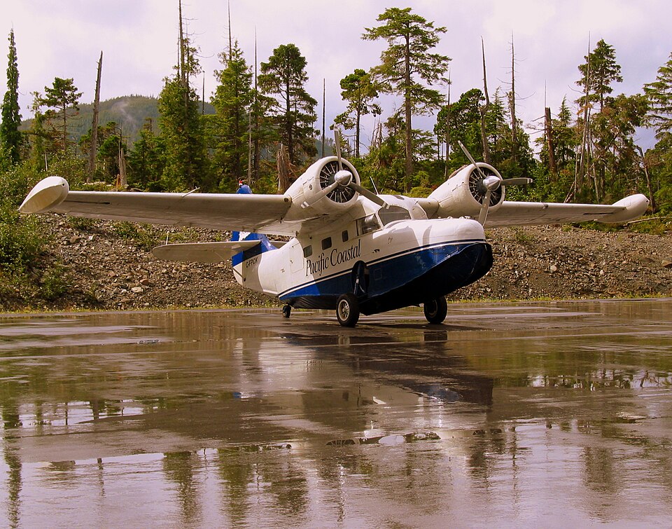
Accident Details
On the day of the accident, at approximately 1013 Pacific Standard Time, a Grumman G-21A amphibious aircraft, registered as C-FPCK and serial number 1187, departed from the water aerodrome at the south terminal of Vancouver International Airport, British Columbia. The flight was operated by Pacific Coastal Airlines and was bound for Powell River, British Columbia, carrying one pilot and seven passengers.
About 19 minutes after departure, the aircraft crashed in dense fog on South Thormanby Island, an island situated roughly halfway between Vancouver and Powell River. Local searchers located a seriously injured passenger on the eastern shoreline of the island around 1400. Approximately 30 minutes later, the aircraft was found on a peak near Spyglass Hill, British Columbia. The pilot and the six other passengers sustained fatal injuries, and the aircraft was destroyed by the impact and a subsequent fire. The emergency locator transmitter (ELT) was destroyed and did not transmit any signal.
Probable Cause
The official investigation identified the following causes and contributing factors: 1. The pilot likely departed and continued flight in conditions below visual flight rules (VFR) weather minima. 2. The pilot continued VFR flight into instrument meteorological conditions (IMC) and did not recognize proximity to terrain until seconds before colliding with Thormanby Island. 3. The indication of marginal weather improvement at Powell River and incorrect weather information from Merry Island may have contributed to the pilot's conclusion that en route weather would be sufficient for a low-level flight.
Other Findings
Several risk factors were noted in the investigation:
- Reliance on a single VHF-AM radio for commercial operations in congested airspace increases the risk of missing important information.
- Low-altitude flight greatly reduces VHF radio reception range, hampering receipt of route-related information.
- Lack of pilot decision-making (PDM) training for VFR air taxi operators exposes pilots and passengers to increased risk in adverse weather.
- Some operators and pilots intentionally skirt VFR weather minima, increasing risk.
- Customer pressure to complete flights despite adverse weather can negatively influence pilot and operator decisions.
- Incremental growth in Pacific Coastal's support to Kiewit did not trigger further risk analysis, exposing pilots and passengers to undetected risks.
- Transport Canada's guidance on risk assessment does not address incremental growth for air operators.
- Previous discussions between Pacific Coastal and the pilot about weather decision-making were not documented under the company's safety management system (SMS), preventing formal risk analysis.
- No company procedures or decision aids (such as decision trees, second pilot input, or dispatcher co-authority) were in place to augment the pilot's departure decision.
- The ELT failure delayed crash notification and location.
- On some flights on the Vancouver–Toba Inlet route, pilots departed over maximum gross weight due to incorrect weight and balance calculations.
- Over-reliance on GPS in low visibility and ceiling conditions presents a significant safety risk.
Additionally, a SPOT Satellite Messenger transmitted data before the crash that helped narrow the search area and reduce search time, although consultation of wrong data initially delayed reporting of the missing aircraft.