History of the Flight
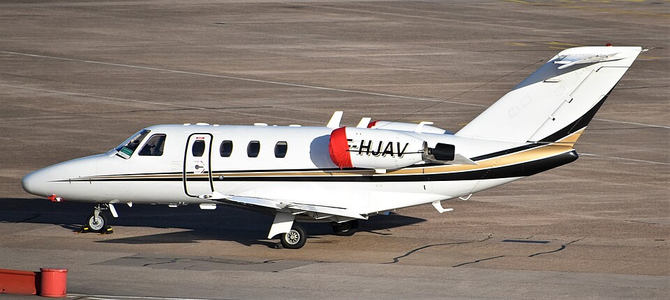
On 14 March 2025, a Cessna Citation 525 CJ1 registered F-HJAV departed Limoges-Bellegarde airport at 17:55 local time, en route to Paris-Le Bourget airport. The flight was a commercial passenger air transport operation with two pilots and two passengers aboard.
At approximately 18:06, while passing through the transition altitude, the pilots noticed a discrepancy between the altitude values displayed on their primary flight displays (PFDs). They compared these altitudes with the standby altimeter, but due to significant differences among the three values, they decided to continue climbing and address the issue once established in cruise.
Around FL 100, an "ALT" indication (or "Amber ALT") appeared on both PFDs, indicating an altitude inconsistency between the captain's and co-pilot's displays. The crew reached cruise at 18:09, with the captain's PFD indicating FL 180. At 18:11, they informed the south-west air traffic control (ATC) of an altimeter issue and asked for confirmation of their flight level. The controller reported seeing FL 180 on radar. The crew then determined that the co-pilot's altitude reading was erroneous and selected air data computer 1 (ADC 1) as the altimetric source for both PFDs.
At 18:16, the aircraft was transferred to north ATC. The crew reported standard flight conditions at FL 180 and did not mention the earlier altimeter problem. Between 18:09 and 18:28, although the autopilot was engaged and ADC 1 indicated a stable FL 180, the aircraft's GNSS altitude progressively dropped from 15,300 ft to 12,600 ft.
At 18:28, ATC instructed a descent to FL 120, followed by FL 90 at 18:31. At 18:34, the crew was asked to contact Paris-Charles de Gaulle (CDG) approach but experienced difficulties establishing communication on the assigned frequency. They eventually contacted the CDG north initial approach controller at 18:40.
At 18:42, while ADC 1 still indicated level flight at FL 90, a "PULL UP TERRAIN" TAWS warning activated. The aircraft was at a GNSS altitude of approximately 1,200 ft (about 700 ft above ground) and descending. The captain disengaged the autopilot, added power, and transitioned to external visual references. The GNSS altitude then increased to around 1,000 ft. The crew asked the controller to verify their radar position and altitude; the controller noted FL 96 on the transponder but cautioned that the displayed altitude might be inaccurate.
At 18:46, the GNSS altitude stabilized at approximately 2,000 ft. The crew established on the localizer for Le Bourget and landed at 18:54. After landing, the CDG controller requested that the aircraft's Mode C transponder be deactivated to prevent erroneous altitude displays.
Meteorological Information
The SIGWX charts indicated no cloud cover or turbulence above FL 100, with some cirrus east of the flight path between 15,000 and 20,000 ft. Below FL 100, stratocumulus clouds existed between 2,500 and 4,500 ft, and moderate icing was possible between 2,500 ft and 10,000 ft for the entire flight.
The 18:00 METAR for Limoges reported wind from 030° at 12 kt, visibility greater than 10 km, broken clouds at 4,900 ft and 5,800 ft, and QNH 1,009 hPa (approximately 110 ft below pressure altitude). The 19:00 METAR for Paris-Le Bourget reported wind from 360° at 7 kt, CAVOK, and QNH 1,005 hPa (approximately 220 ft below pressure altitude). The captain noted that the setting sun reflecting on a thin cloud layer reduced visual references of the ground.
Aircraft Information
The Cessna Citation 525 CJ1 is a light business jet certified for single-pilot operations under CS-23. Valljet operated it in multi-pilot commercial air transport flights. The aircraft has a maximum take-off weight of 4,808 kg and can carry up to six passengers and two crew members. F-HJAV was not equipped with flight recorders, as this was not a regulatory requirement. It featured an integrated GNSS navigation system (GTN750xi) that provided GNSS altitude, though this information was not shown on the default display.
The air data system comprised two independent air data computers (ADCs). System 1 (captain's side) used a left-side Pitot tube and static ports on both fuselage sides; its altitude data fed the captain's PFD. System 2 (co-pilot's side) used a right-side Pitot tube and static ports, with data going to the co-pilot's PFD. A standby altimeter and airspeed indicator were connected to System 2 without passing through ADC 2. An optional alternate static source in the nose compartment could be selected manually. The active transponder (transponder 1) received altitude from ADC 1, while transponder 2 was connected to ADC 2; the sources were not interchangeable.