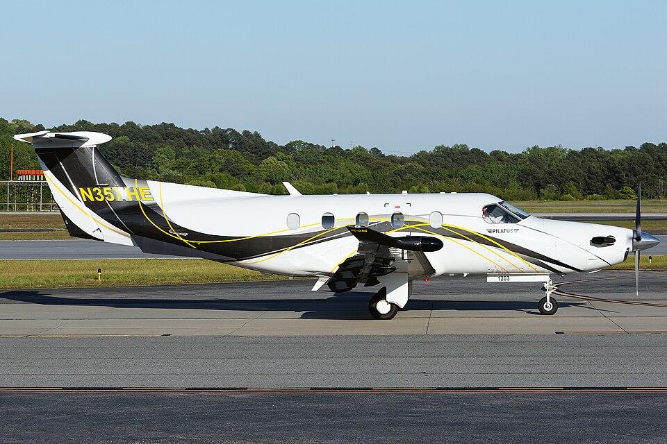
Accident Overview
On July 26, 2024, about 1304 mountain daylight time, a Pilatus Aircraft LTD PC-12/47E airplane, registration N357HE, was destroyed when it crashed near Recluse, Wyoming. The pilot and six passengers sustained fatal injuries. The flight was conducted under Title 14 Code of Federal Regulations Part 91 as a personal flight.
Flight History
ADS-B data from the Federal Aviation Administration (FAA) indicated that the airplane departed Nebraska City Municipal Airport in Nebraska City, Nebraska, about 1200, and proceeded on a northwest track toward Billings Logan International Airport (BIL) in Billings, Montana. It climbed to a maximum cruise altitude of about 26,000 ft mean sea level (msl).
Around 1302, the airplane deviated to the right of its course, climbing to about 27,550 ft msl and executing a 270° right turn. During the first 180° of the turn, it descended to approximately 25,250 ft msl, then climbed to about 27,025 ft msl over the final 90°. Shortly thereafter, the airplane made a slight left turn before initiating a descending 180° right turn. The last ADS-B data point showed the airplane on a southerly heading at an altitude of about 21,900 ft msl with a groundspeed of 256 knots.
During the final portion of the flight, the pilot reported to the Salt Lake City Air Route Traffic Control Center that the autopilot was lost and declared an emergency. The controller asked where the pilot wished to land, but received no initial response. The pilot then stated he was trying to regain control, and the controller offered assistance and advised of the minimum instrument flight rules altitude and current altimeter setting. No further transmissions from the pilot were received.
After loss of radio and radar contact, the FAA issued an Alert Notice (ALNOT). The airplane was subsequently located by local law enforcement in remote terrain approximately 12 miles northeast of Recluse, Wyoming.
Witness Accounts
One witness near the accident site reported hearing a “loud whining noise” that diminished, then increased, followed shortly by smoke emanating from the area. Another witness observed the airplane overhead performing a “barrel roll” maneuver and heard the engine “roaring loud” until the sound of impact. This witness also saw smoke shortly after.
Wreckage Examination
Examination of the accident site showed that the airplane impacted terrain on a magnetic heading of about 099°. The main wreckage rested at an elevation of about 4,030 ft msl on a slope of about 20°. The initial impact point was a ground disturbance measuring about 10 ft in length, 41 ft in width, and 6 ft in depth, with a majority of the wreckage embedded.
Surrounding the ground disturbance was a large area of burnt vegetation. Small airplane fragments were scattered within an approximate 300 ft radius from the main wreckage. A post-impact fire ensued, covering about 40 acres primarily to the west of the main wreckage.
Two sections of the left wing and various fragments were found along a debris path extending about 0.82 miles from the main wreckage on a heading of about 300° magnetic. All major components of the airplane were contained within the accident site and debris path. The wreckage was recovered to a secure facility for further examination.