Background
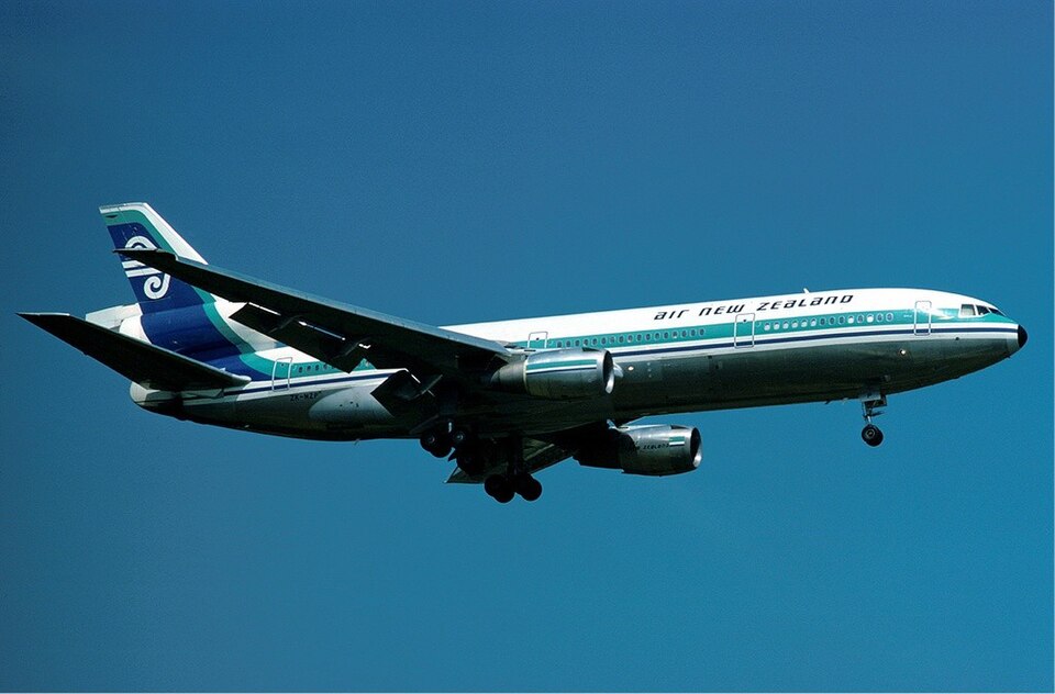
Flight TE901 was a non-scheduled domestic scenic flight operated by Air New Zealand with a DC-10-30 (registration ZK-NZP). The flight departed from Auckland Airport at 1917 hours Z on November 27, 1979, with an intended first landing at Christchurch. The flight deck crew comprised a captain, two first officers, and two flight engineers. Fifteen cabin crew and a flight commentator experienced in Antarctic exploration were also on board. The passenger load was reduced by 21 from normal seating capacity to facilitate movement and viewing of Antarctic scenery.
Flight Preparation
Nineteen days before the flight, two pilots attended a route qualification briefing. This briefing included an audiovisual presentation, a printed briefing sheet, and a 45-minute DC-10 simulator flight to familiarize with grid navigation procedures south of 60° south latitude and the visual meteorological conditions (VMC) letdown procedure at McMurdo. The briefing detailed the instrument flight rules (IFR) route to McMurdo, which passed almost directly over Mount Erebus, a 12,450-foot active volcano, about 20 nautical miles before the turning point at Williams Field. The minimum instrument meteorological conditions (IMC) altitude was 16,000 feet, and the minimum altitude after passing McMurdo was 6,000 feet, provided conditions exceeded specified minima.
On the day of the flight, the crew conducted normal pre-flight dispatch planning. The flight was dispatched using an IFR computer-stored flight plan. Pre-flight weather information from the McMurdo meteorological office indicated Ross Island was under a low overcast with a base of 2,000 feet, light snow, visibility of 40 miles, and clear areas approximately 75 to 100 nautical miles northwest of McMurdo. Additionally, Scott Base advised that the dry valley area (Wright and Taylor Valleys) was clear and would be a better sightseeing option.
Accident Sequence
During the flight, the captain requested the commentator's guidance to the clear area over the Wright and Taylor Valleys. The commentator agreed and asked if the captain wished to head there immediately; the captain replied he would prefer to go to McMurdo first. The US Navy Air Traffic Control Centre (ATCC) "Mac Centre" offered the crew the use of surveillance radar to descend to 1,500 feet during the approach to McMurdo, which the crew accepted. However, the aircraft was not located by radar before initiating descent or at any other time.
The crew experienced difficulty establishing very high frequency (VHF) radio contact, and the distance measuring equipment (DME) failed to lock onto the McMurdo Tactical Air Navigation System (TACAN) for any useful period. Communication with ATC during the latter part of the flight relied primarily on high frequency (HF) radio.
The area approved for VMC descents below 16,000 feet became obscured by cloud as the aircraft approached. The crew elected to descend in a clear area north of Ross Island using two descending orbits—first to the right, then to the left. They received clearance from Mac Centre to descend from 10,000 to 2,000 feet VMC on a heading of 180° grid (013° true) and proceed visually to McMurdo. However, the aircraft only descended to 8,600 feet before completing a 180° left turn to 375° grid (190° true), during which it descended to 5,700 feet. The descent continued to 1,500 feet on the flight-planned track back toward Ross Island. Shortly after this final descent, the aircraft collided with Ross Island.
The ground proximity warning system (GPWS) operated correctly before impact. The crew responded by the flight engineer calling out heights of 500 and 400 feet above ground, and the captain called for go-around power. The engines were at a high power setting, and the aircraft had rotated upward in pitch immediately before impact. The aircraft struck an ice slope on Ross Island, began breaking up, and a fire initiated and persisted in the fuselage cabin area after coming to rest. The accident occurred in daylight at 0050 hours Z at coordinates 77°25'30"S, 167°27'30"E, at an elevation of 1,467 feet above mean sea level. Cockpit voice recorder and digital flight data recorder data showed the aircraft was operating satisfactorily and the crew was not incapacitated before the accident.
Probable Cause
The official probable cause of the accident was the captain's decision to continue the flight at low level toward an area of poor surface and horizon definition when the crew was not certain of their position, and the subsequent inability to detect the rising terrain that intercepted the aircraft's flight path. The investigation also identified several contributing findings, including errors in the flight plan computer entry, misleading diagrams in the briefing, omissions in the route qualification briefing, and inadequate oversight by airline inspectors.