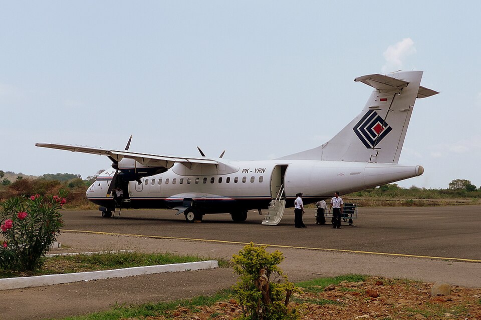
Accident Details
On 16 August 2015, an ATR 42-300 aircraft registered PK-YRN, operated by PT Trigana Air Service, was conducting scheduled passenger flight IL267 from Sentani to Oksibil, Indonesia. The flight was the fifth of the day and the second on that route. The aircraft departed Sentani at 0522 UTC with an estimated arrival at Oksibil at 0604 UTC. The Second in Command acted as Pilot Flying, and the Pilot in Command acted as Pilot Monitoring.
Weather and Approach
The weather at Oksibil was reported as broken clouds (more than half the sky covered) with a cloud base of 8,000 feet (4,000 feet above airport elevation). Visibility was 4 to 5 km. The final approach path was covered by clouds. The aircraft cruised at 11,500 feet. At 0555 UTC, the pilot made first contact with Oksibil Aerodrome Flight Information Services (AFIS) officer, reporting on descent at position Abmisibil and intending to direct left base leg for runway 11. At 0600 UTC, the AFIS officer expected the aircraft on final, but the pilot had not reported. The officer contacted the pilot without reply and informed Trigana in Sentani that contact had been lost.
Wreckage and Investigation
The wreckage was found on a ridge of Tanggo Mountain, Okbape District, Oksibil, at approximately 8,300 feet AMSL, coordinates 04°49’17.34” S, 140°29’51.18” E, about 10 NM from Oksibil Aerodrome on a bearing of 306°. All 54 occupants were fatally injured. The aircraft was destroyed by impact and post-impact fire. The Flight Data Recorder (FDR) and Cockpit Voice Recorder (CVR) were recovered. FDR data recovery was unsuccessful due to damage. CVR data from the accident flight was retrieved successfully. The CVR did not record any crew briefing, checklist reading, or EGPWS warning prior to impact. EGPWS altitude callouts were also absent on two previous flights. The investigation concluded that the EGPWS was probably not functioning.
Findings
The investigation identified several findings, including: the aircraft had a valid Certificate of Airworthiness and was operated within weight and balance limits; all crew had valid licenses; the flight plan was filed for IFR at flight level 155, but the aircraft cruised at 11,500 feet, well below the MORA of 18,500 feet. The approach deviated from the operator's visual guidance, which required flying overhead the airport before approaching runway 11. Witnesses stated that crews frequently deviated from the visual approach guidance. The FDR had a history of recording issues, and operator surveillance of the repair station was ineffective. Spectrum analysis showed both engines were operating prior to impact. Several pilots had a habit of pulling the EGPWS circuit breaker to eliminate nuisance warnings; this behavior was not corrected. The EGPWS installation did not follow the manufacturer's service bulletin. The terrain database version did not include high-resolution data for Oksibil. The operator's visual approach guidance chart listed 8,000 feet as the minimum safe altitude, but the impact occurred at 8,300 feet, indicating chart errors. Maintenance records were poorly documented, and there was no regulation for pilot training after system modifications. No NOTAM was issued for the status of the ZX NDB. The regulator's oversight of the operator was not well implemented.
Contributing Factors
The contributing factors were: 1) Deviation from the visual approach guidance under visual flight rules without considering weather and terrain, with no or limited visual reference, resulting in controlled flight into terrain. 2) The absence of EGPWS warning, which would have alerted the crew to the immediate hazardous situation.