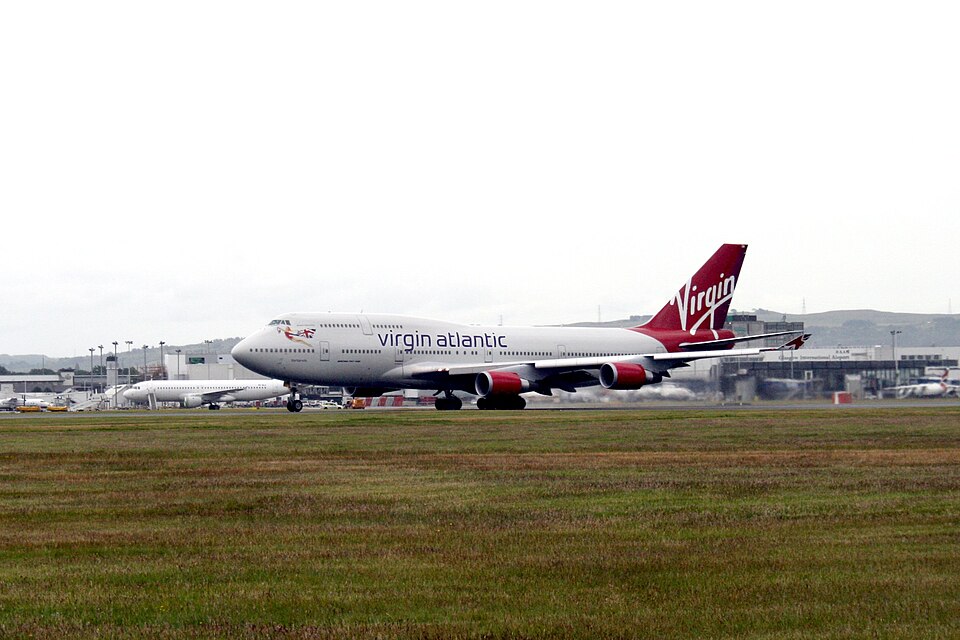
Incident
On 26 July 2005 at 2107 UTC, a Boeing 747-443, registration G-VROM, encountered severe turbulence approximately 100 nautical miles north-east of Nassau, Bahamas. The aircraft was operating a scheduled public transport flight from Nassau to London Gatwick Airport. There were 18 crew members and 278 passengers on board. Minor injuries were reported among 14 crew and 10 passengers. The aircraft sustained minor cabin damage.
Flight History
The flight departed Nassau at 2047 UTC. The planned route, plotted on a Significant Weather Chart, passed south of Tropical Storm Franklin, which was located about 600 nm northeast of the Bahamas. A band of weather associated with Franklin contained isolated embedded cumulonimbus clouds. The co-pilot, who was the pilot flying, climbed the aircraft in visual meteorological conditions to the initial cruising level of FL310. Weather radar was used during the climb; returns showed some cumulonimbus activity away from the intended track. No weather or turbulence was encountered initially, so the seat belt signs were switched off.
The flight crew had discussed Tropical Storm Franklin and had marked two SIGMET areas on a chart: area E3 (received before departure) and area K23 (received after the turbulence encounter). These SIGMETs indicated areas of moderate turbulence associated with the storm. The aircraft entered an area of cirrus cloud followed by light turbulence, prompting the commander to switch on the seat belt signs. Shortly after, severe turbulence occurred. The autopilot remained engaged, and the turbulence ceased after about 15 seconds.
Doctors traveling on the aircraft assisted with treating the injured. The commander, in consultation with the flight service manager, decided that a diversion was not medically necessary. The flight crew checked aircraft systems and, after discussions with company operations and maintenance control, continued to Gatwick without further incident.
Turbulence Encounter
Data from the flight data recorder showed that after leveling at FL310 with an autopilot in VNAV mode, the aircraft encountered light turbulence at 2105:08 UTC, which increased in amplitude. At 2106:50, the static air temperature had dropped to -33.8°C, and vertical acceleration varied between +0.82 and +1.44 g. The autopilot then switched to altitude hold mode. The peak turbulence occurred at 2107:02, with vertical accelerations between -0.58 g and +2.13 g over three seconds. The maximum speed reached Mach 0.876, and the minimum was Mach 0.839. Wind direction varied between 024° and 064°, with speeds from 13 to 21 knots. Altitude deviations ranged from +115 ft to -75 ft from the selected altitude.
Flight Planning
The operator's flight planning department initially selected the route. A flight planning officer re-routed the track to the south of Tropical Storm Franklin, as an alternative northern route was moving toward the storm. This rerouting was annotated on the flight plan. The flight planning officer who prepared the plan was a senior officer, as only senior officers plan Caribbean routes during tropical storm or hurricane activity. The flight planning manager confirmed the route was consistent with normal practice.